Purpose
- Elevation of points on google map
- EGM96 geoid separation
- Tidal datums using VDatum
- GEOID12B separation usign VDatum
Disclaimer
Not suitable for any survey.
Status
Beta
Method
Uses google map elevation API. Most data probably comes from SRTM. But some location data seems to be from Lidar elevation dataset. Google uses WGS84 and EGM96 (OGC KML 2.2 standard). Hence, elevation is referenced to EGM96 geoid.
Other output data are:
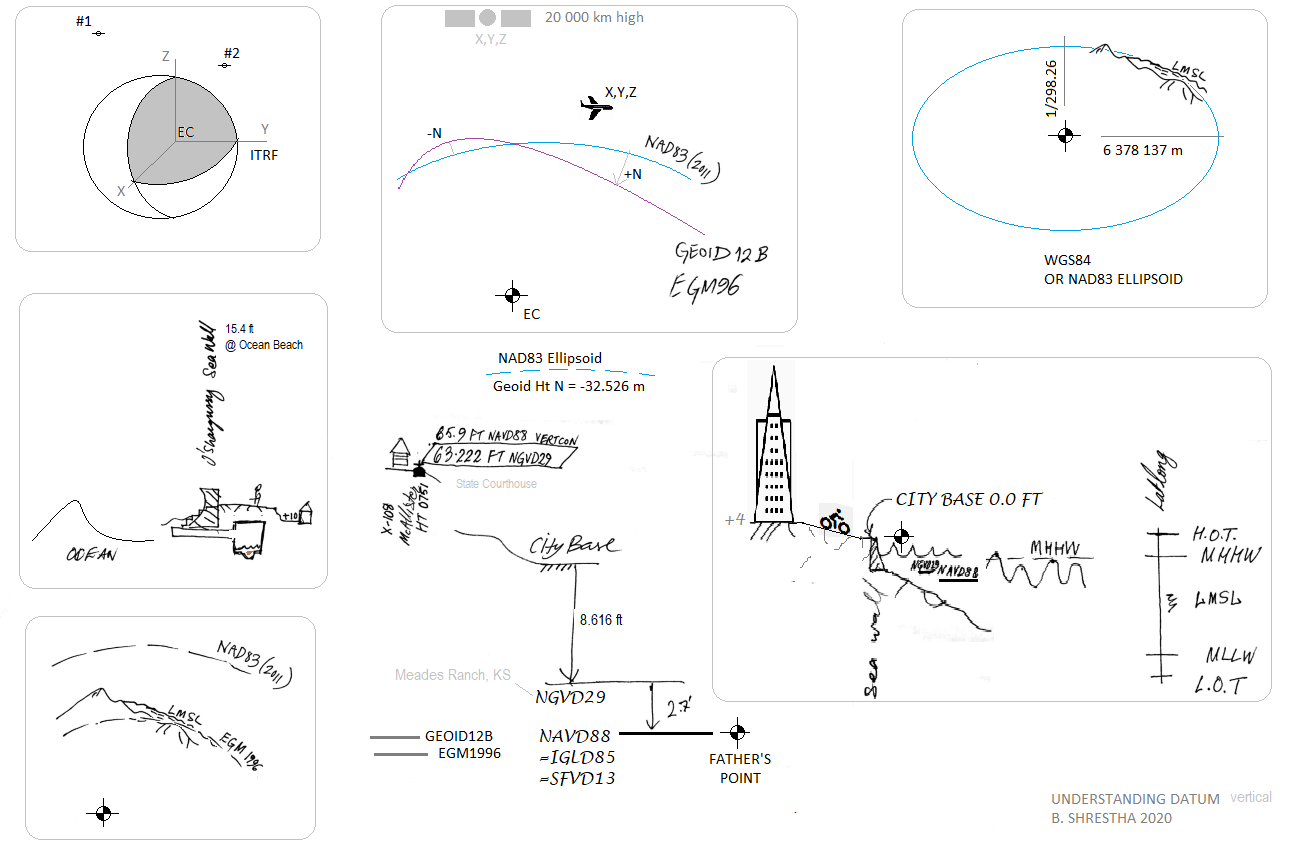
EGM96 Geoid Separation;
Tidal datum like MLLW, MHHW, LMSL, Geoid separation using VDatum.
NAVD88 ELEV = GEOID12B - h - EGM96
Instructions
- Click on map to start collecting data
- Hover or click on icon to read data
- Use tables to see all data
- Use CAD to plot points in AutoCAD
- Use + button to locate user
- Reset clears all data
Options
- Worldwide data
- For CA State Plane Zone III, additional coordinates x, y feet are available
- Elevation unit conversion and datum adjustment
- Use Group name to identify points
- CAD is for plotting in AutoCAD points x,y,z
- SF elevation is calculated by subtracting 8.15 feet from the LMSL
- Center map to user location
Glossary
CA III : California State Plane III US Survey feet
EGM96 : Earth Gravity Model 1996
LMSL : Local Mean Sea Level
NAVD88 : North American Vertical Datum of 1988
SRTM : Satellite Radar Topography Mission
Limitations
- All limitations of google map elevation api
- Google Elevation dataset is from various sources
- Accuracy is not uniform
- Not suitable for any survey
- Elevation is in metres above Local Mean Sea Level (LMSL)
Resources
- google map api
- OGC KML 2.2
- google data
- other data sources
- mean sea level
- Topography
- SF Vertical Benchmarks
- NGS Benchmarks
- VDatum
-
Conversions
-
SRTM
-
Open Altimetry
- GEOID EGM
- GEOID12B
- CDP Engineers: NAD83 & WGS84 Explanation
Updates
2020 B. Shrestha
2018 B. Shrestha
2017 B. Shrestha